Our drone maps are very accurate and will be very helpful for the jobsite and beyond. These maps will be provided with all 2021 pre-construction videos with a link and have many benefits:
- High resolution monolithic image of the entire construction site existing conditions to supplement video, including zooming capabilities (down to cracks in pavement and OUPS markings)
- Save field time & cost with unlimited linear and area measurements built into the viewing software, all of which can be edited and saved automatically in the cloud
- ‘Map Compare’ mode which allows ‘slider’ comparison of progress maps or post-construction maps example link below
- ‘Overlay’ feature which allows clear views of pre-construction and post-construction features
- Verify contract quantities, even use your work for quantity agreements with engineers and owners
- Apply markers and text notations to maps for project team communication
UAS Technology Meets Cloud Workstation

- Drone images are stitched together to form a high-resolution, dimensionally accurate, aerial project map easily accessible in the cloud.
Document Existing Conditions
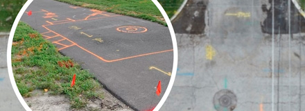
- Supplement preconstruction video, capture OUPS markings, cracks in pavement, existing site layout, etc.
Track Contract Quantities in the Cloud
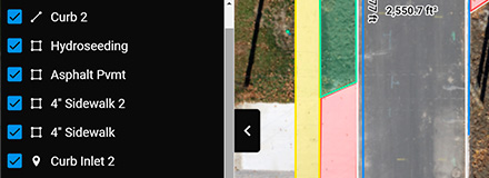
- Count, linear, and area takeoff tools
- Edit, Save, and Export your work
- One click, no-login link to share access to anyone with internet access
Track Project Progress
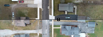
- Enter “Compare Mode” and drag before and after slider bar across your project maps
- Convenient timeline ribbon allows you to organize and switch between different map dates
Supplement Field Inspection
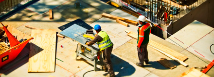
- Reduce field visits, phone calls, and construction inspector work loads.
- Extra tool for project inspectors to track progress, daily/weekly/monthly site changes, and double check pay item quantities.
Collaborate with Project Team

- Communicate and send punch list items, site tasks, and send to stakeholders
- Enter overlay mode using CAD or PDF files
Behind the Technology
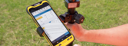
- Ground level GPS receivers and Drone technology allow us to create 2D maps which are within inches of real world precision accuracy.
- Aerial drone 20 megapixel camera will allow zooming all the way down to cracks in pavement.
Other Use Cases for UAS Mapping in Construction
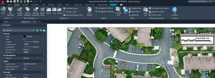
- Digital Takeoff Program Integration – Upload your 2D Aerial Map into your favorite takeoff program, scale it, and obtain high-accuracy takeoffs for estimating, progress quantities, and final quantity surveying.
- CAD Integration – Import your construction map to AutoCAD, Civil 3D, Microstation, Google Sketchup, AutoCAD Lt, Inventor, Solidworks, Trimble Business Center.
Design Process Planning
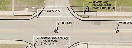
- Used by professional engineers to underlay on CAD project drawings to enmesh actual existing conditions with their linework to bring clarity and field reality to the construction planning and building process.
GIS Programs
- Used by states, cities, counties, and townships to keep their Geographical Information Systems updated, accurate, and within GPS grade precision.
Quantity Surveying
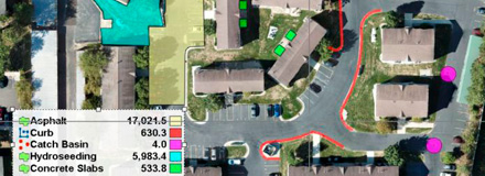
Above: Planswift Example of 2D aerial map used with an On-Screen Takeoff Program producing high-precision, pre or post construction quantity takeoff.
- Used by professional engineers and contractors alike to create 2D map snapshots upon project completion to eliminate disputes and obtain survey grade quantities. Used for the determination of contract pay quantity items such as: Concrete curb, Asphalt Roads, sidewalks, drives, storm & sanitary sewers, water systems, seeding, erosion control, etc.
Construction Progress Photos
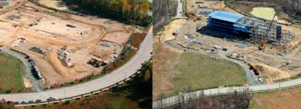
- Provide linear roadway or site pre-construction, progress, and post-construction progress photos.
- Can be used anywhere from:
- One-time information/marketing shots
- Weekly or monthly progression maps
- Daily maps used by management/project ownership personnel to track day to day progress and logistics.
- Commonly used by Safety & Compliance Officers to identify & manage safe & efficient equipment & material logistics for construction, mining, refinery, more.


